When the Ranger tells you to hike to Fitz Roy on this day, don’t question it and just do it. So with our day of “rest” behind us we were hiking Laguna de Los Tres trail and just hoped our bodies were recovered enough to hike the 13 miles to the base of Fitz Roy and back. And the Ranger was right about the perfect sunny conditions.

Instead of starting at the trail head from town and doubling back, we took a shuttle to Hostel El Pilar, about a 30 minute drive north, to start the hike from there. The advantage of starting the hike from El Pilar is the opportunity to see a different part of the park including close-up views of Piedras Blancas glacier and the north side of Fitz Roy, which you would not see if starting and finishing the hike from town. It’s also less steep, a shorter distance (18km vs. 20km) and fewer people. The downside is that you will start the hike with 20 of your fellow passengers and you won’t be facing Fitz Roy all the way.
El Pilar-The Alternative Route
The first part of the hike started with a gradual climb with some steep sections along the Rio Blanco, mostly through lenga forests.
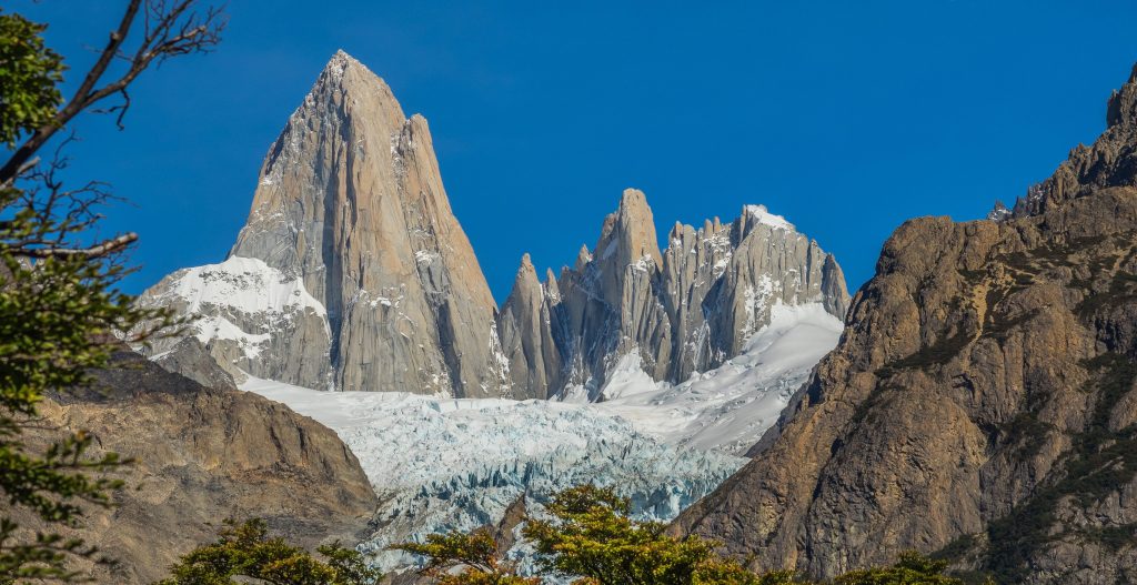
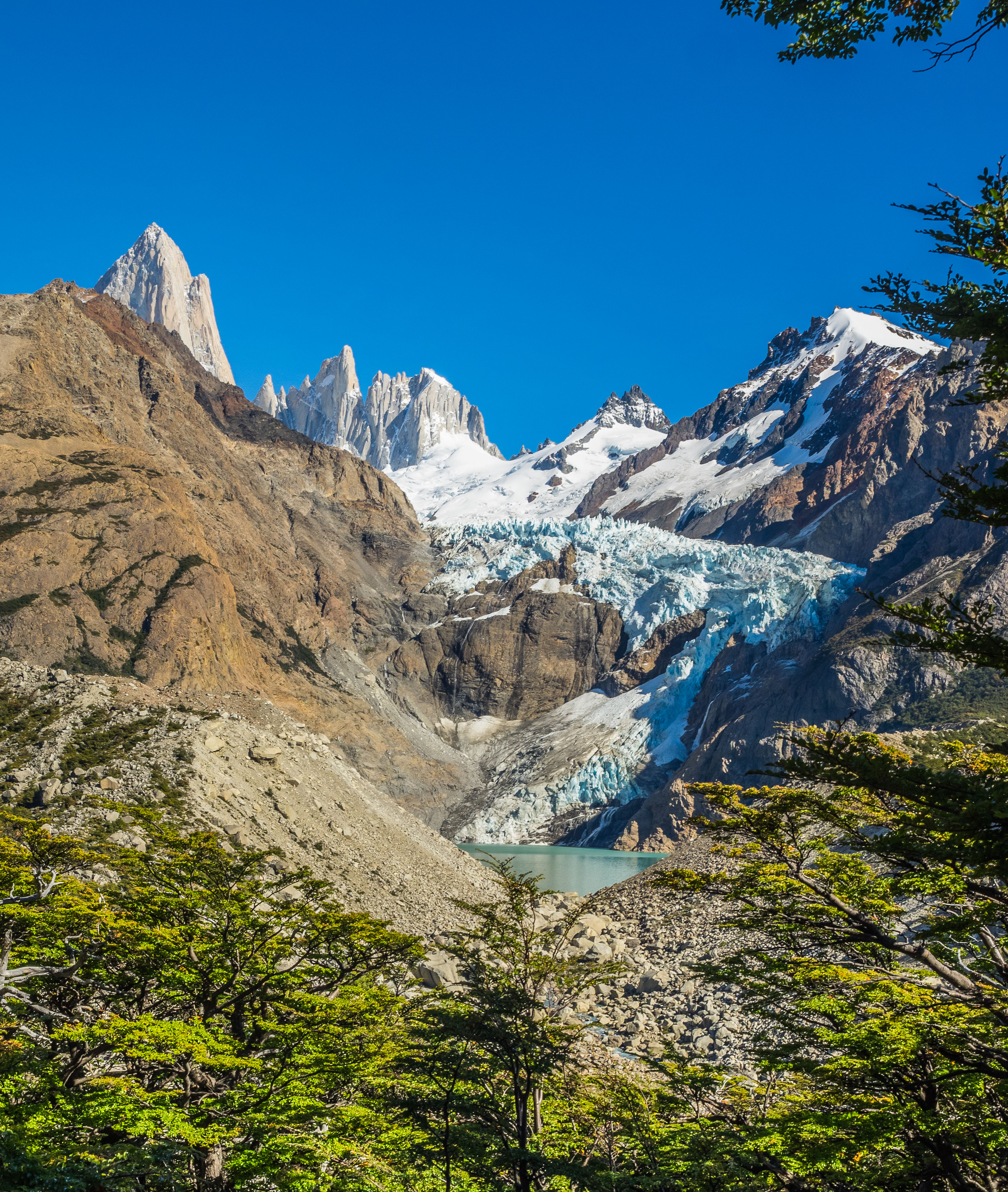
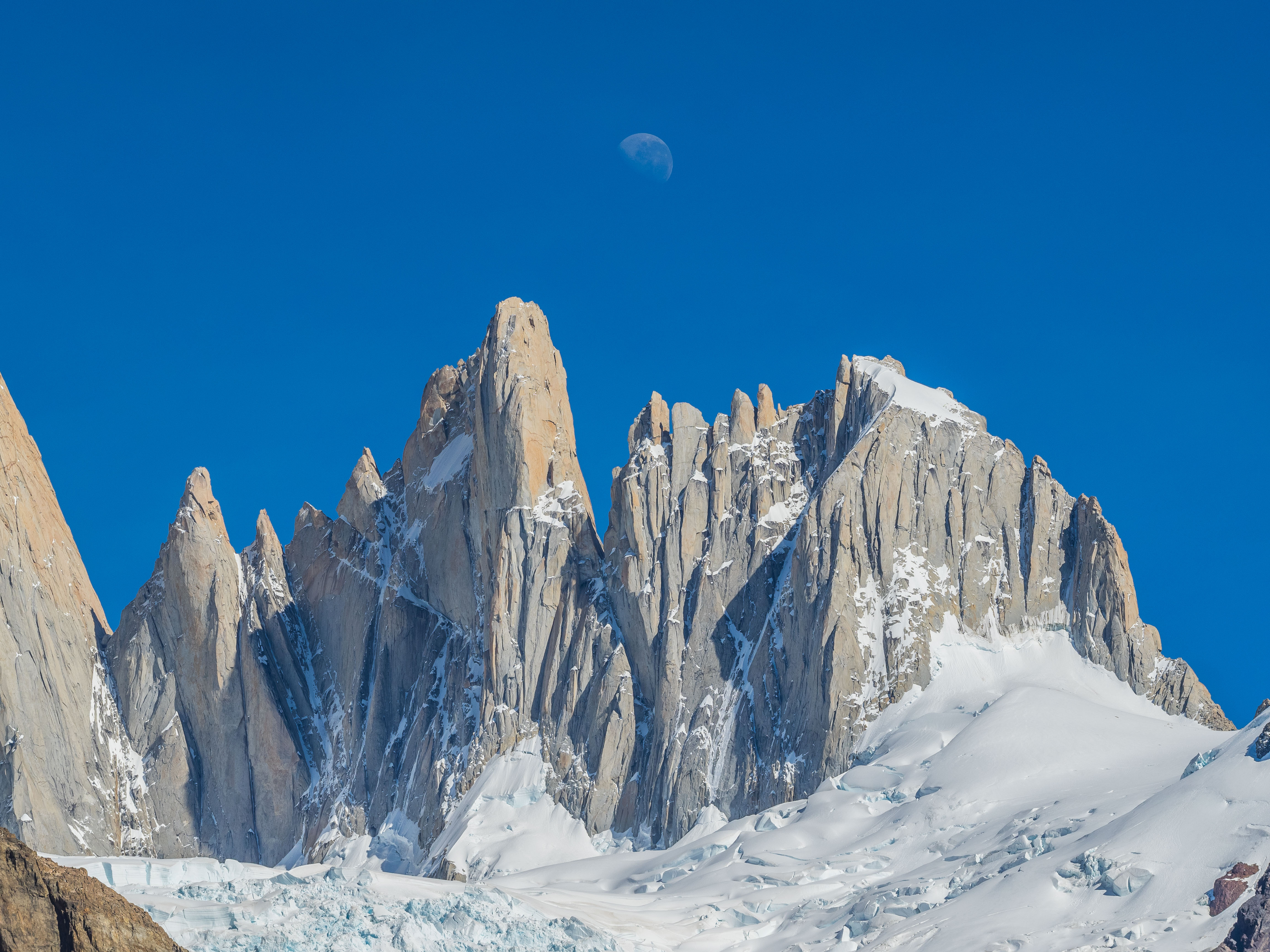
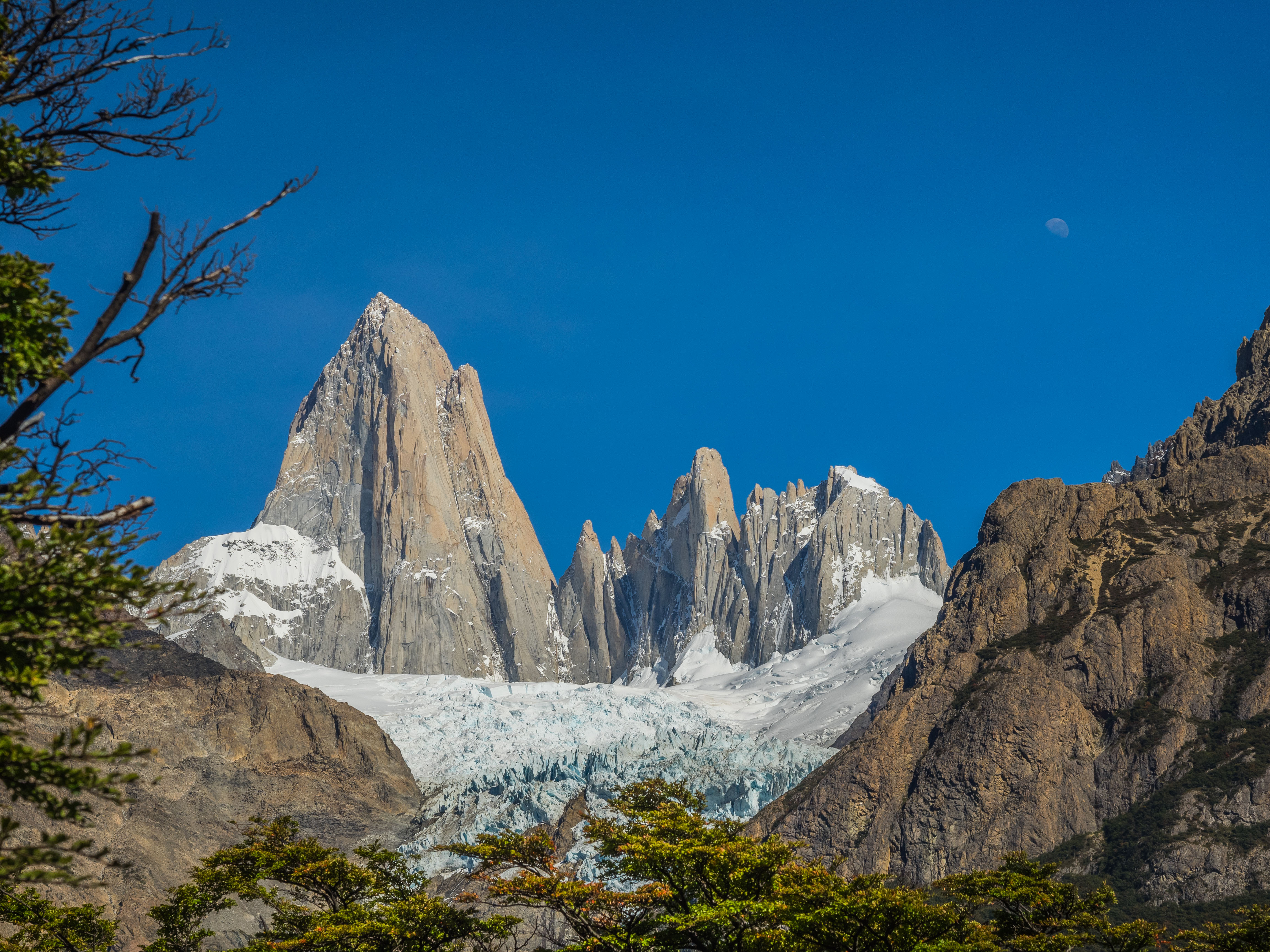
 Every now and then we would get great views of the Piedras Blancas glacier and Fitz Roy through the gaps in the trees. Eventually we reached the viewpoint where a morning quarter moon hovered above the jagged peaks of Fitz Roy, which added to the beauty of the views.

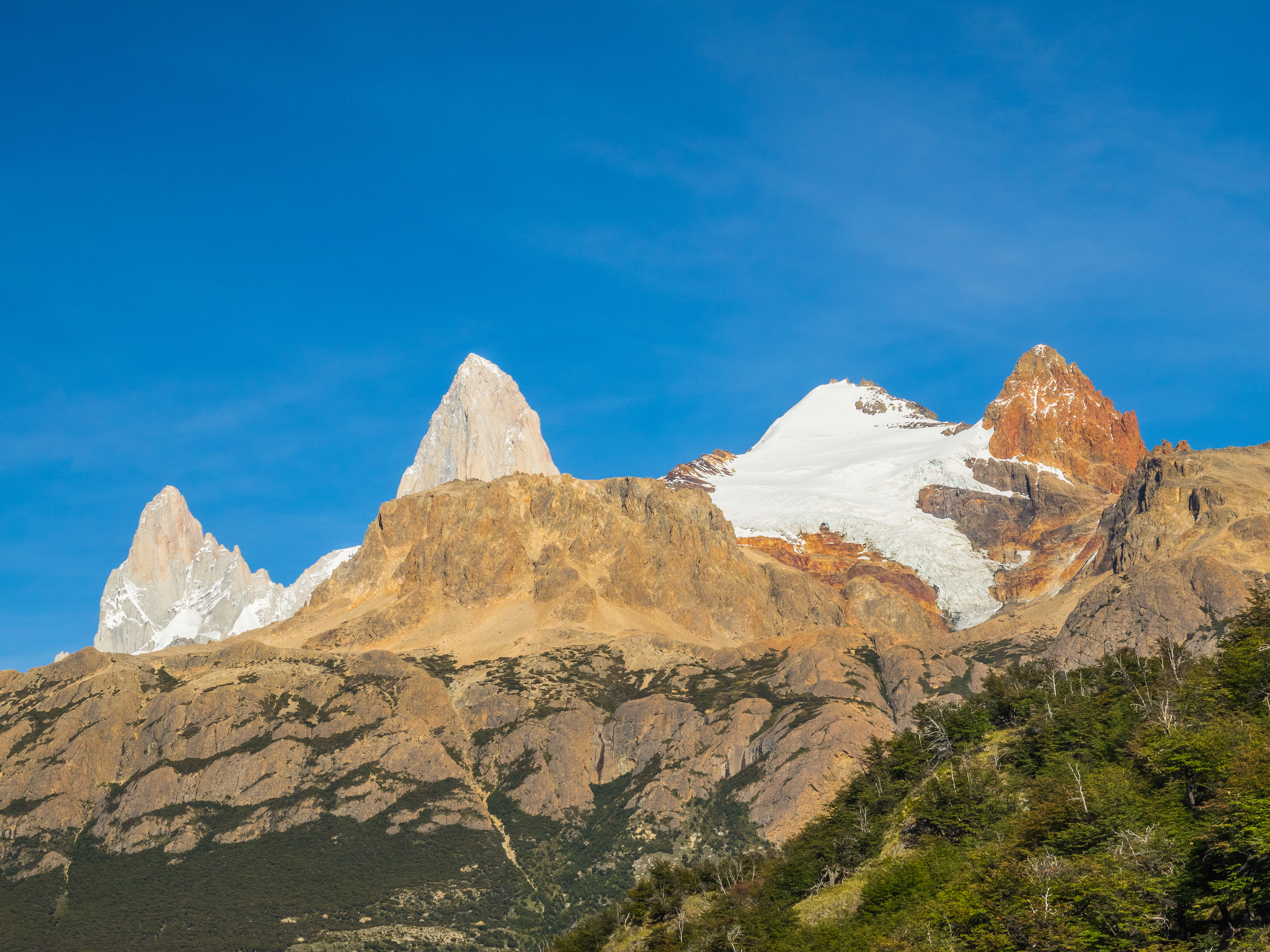
 After a bit more climbing with more amazing views, we reached an intersection and followed the signs to Laguna de Los Tres.

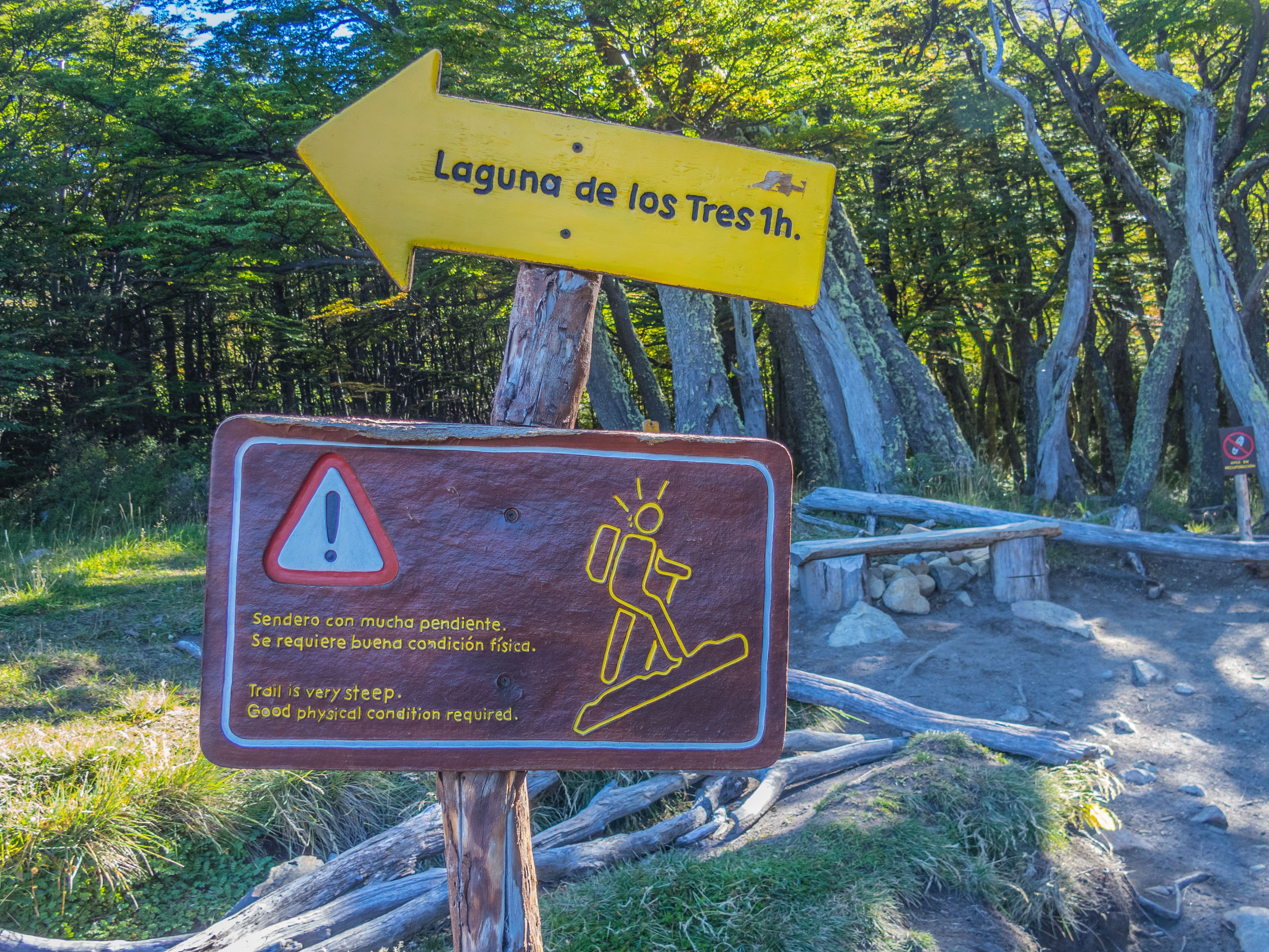
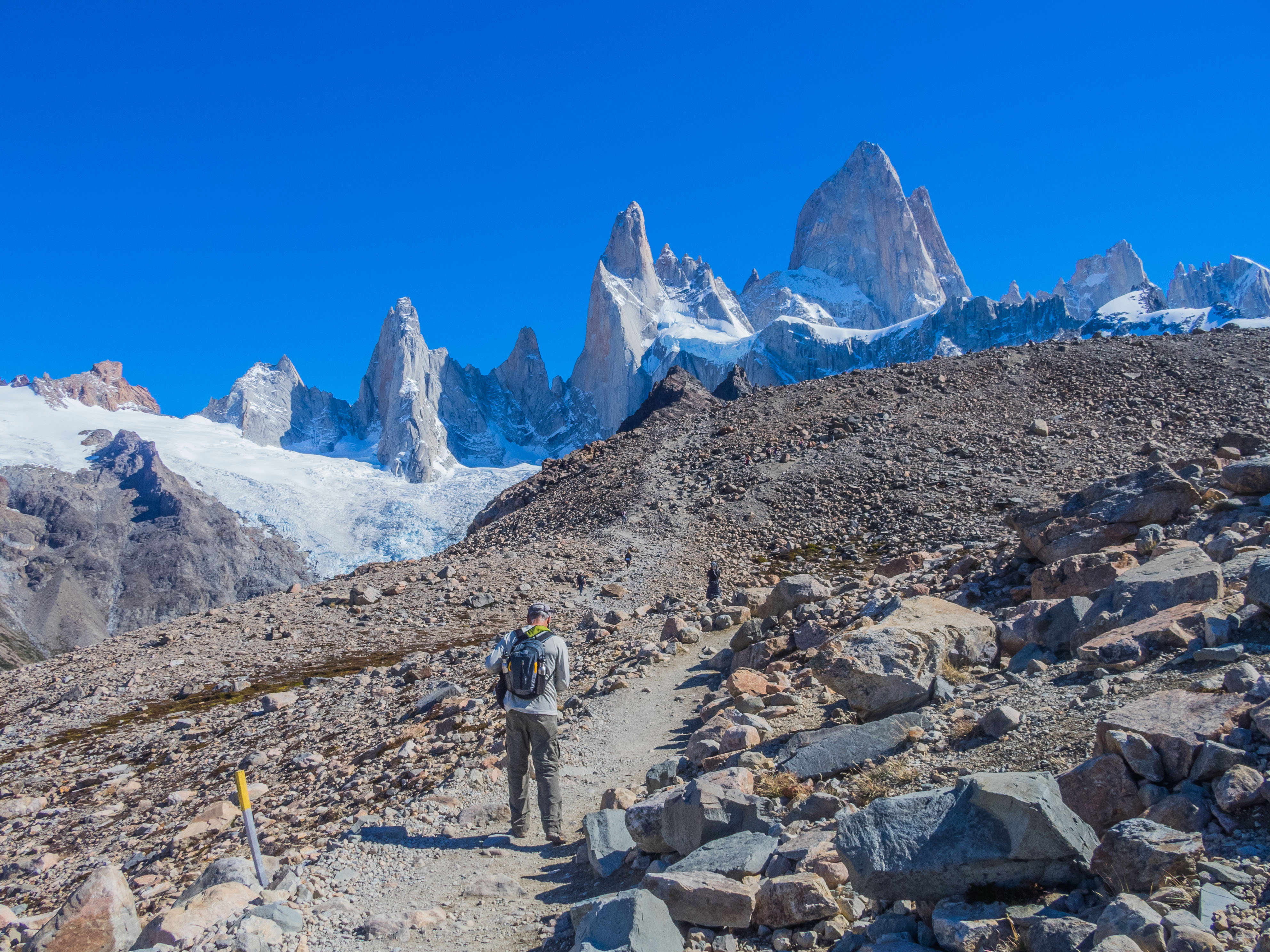
 We passed the Poincenot campground and crossed a couple of rivers before starting the most challenging section of the hike, a tough rocky steep uphill climb with an elevation gain of nearly 1,300 feet in less than a mile. We paused at the base to mentally prepare ourselves for the final ascent to Fitz Roy. This warning sign at the start of the climb didn’t exactly encouraged us.
 Unfortunately, no amount of mental preparation made a difference. The last climb was like scaling the side of a mountain and took all our effort to keep going. By this time we lost sight of Sally who quickly scaled the mountain with the speed and agility of a mountain goat. We finally reached the plateau only to find out we had another giant pile of scree to climb before reaching the laguna.
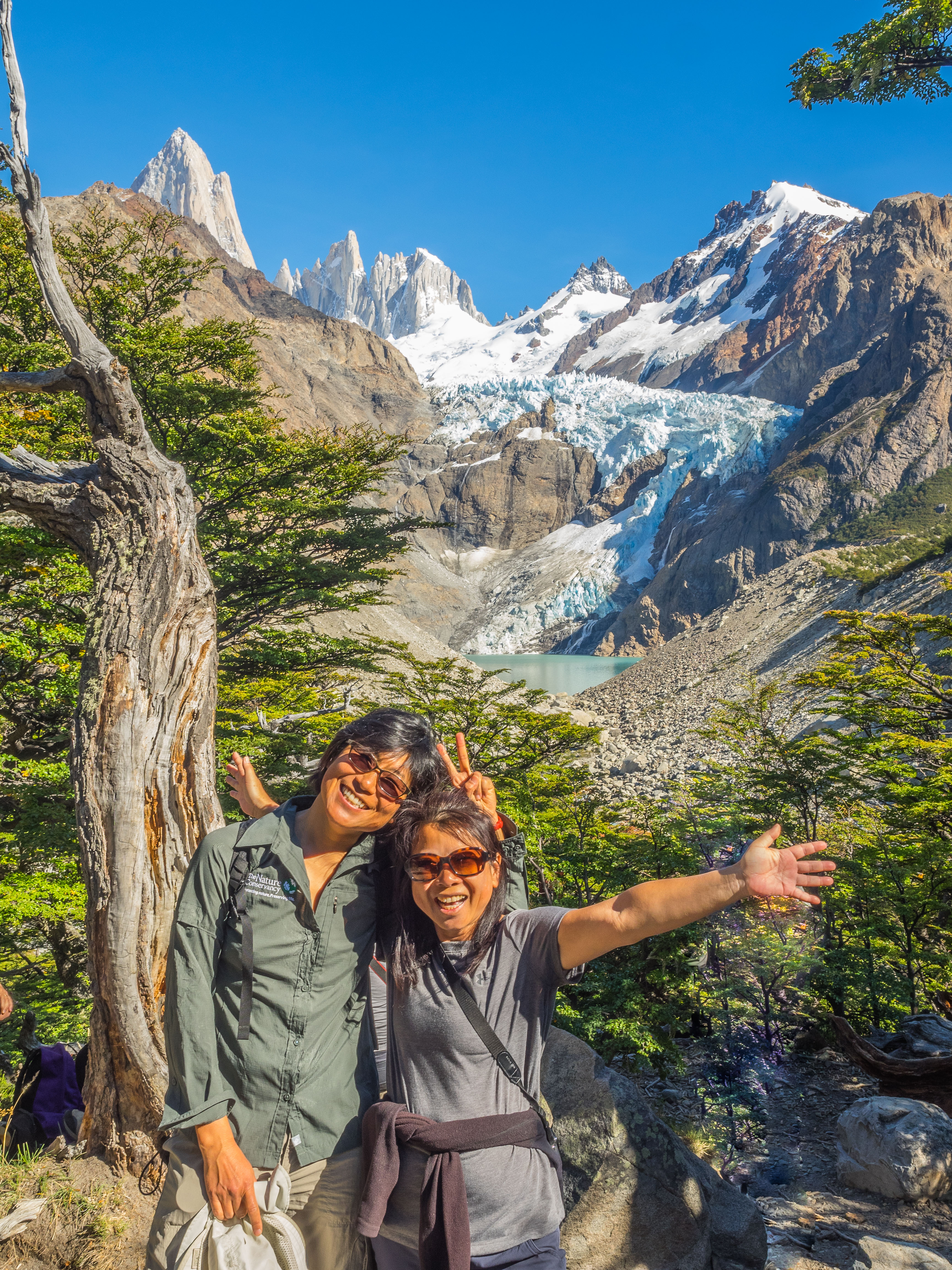
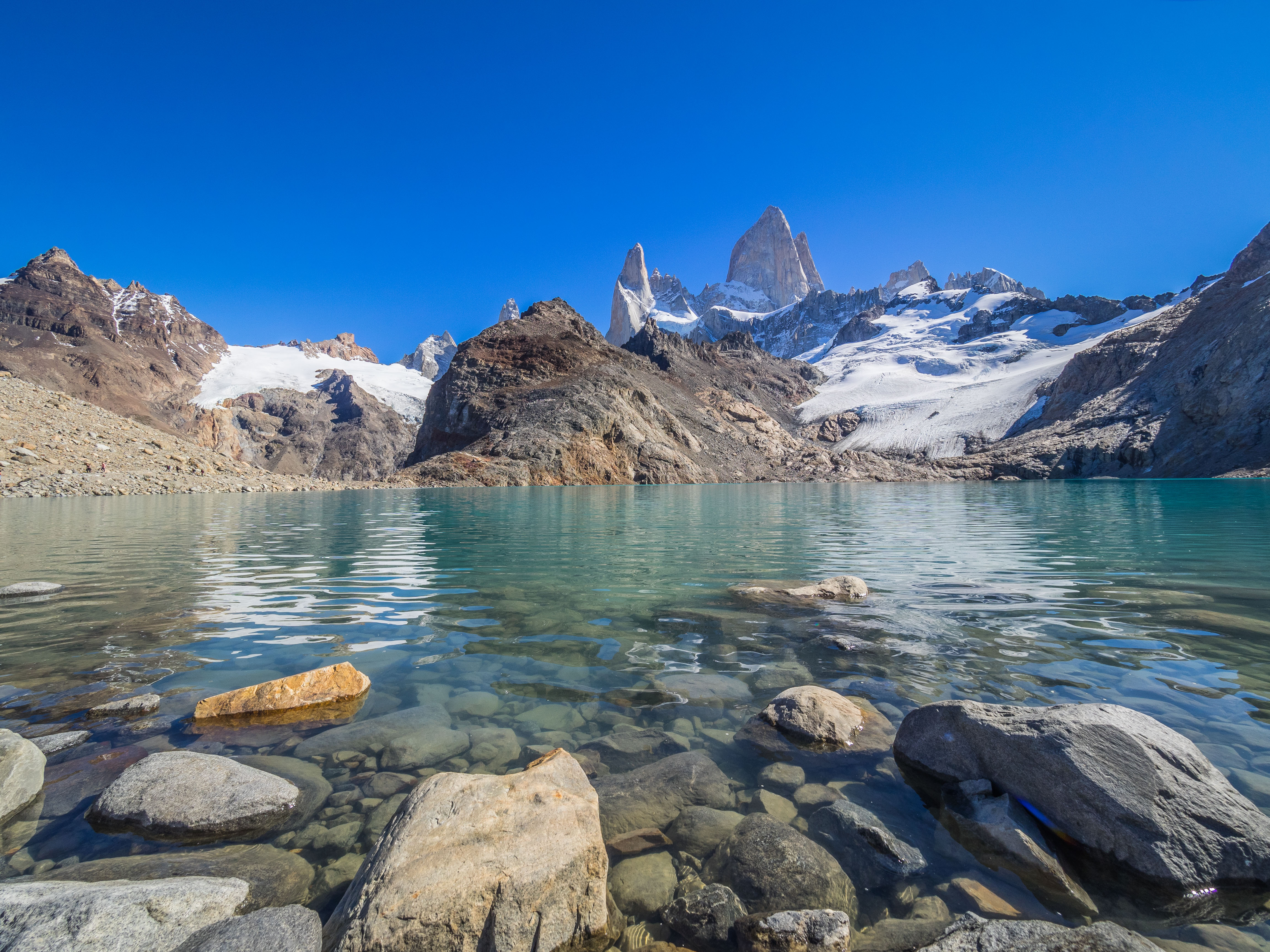
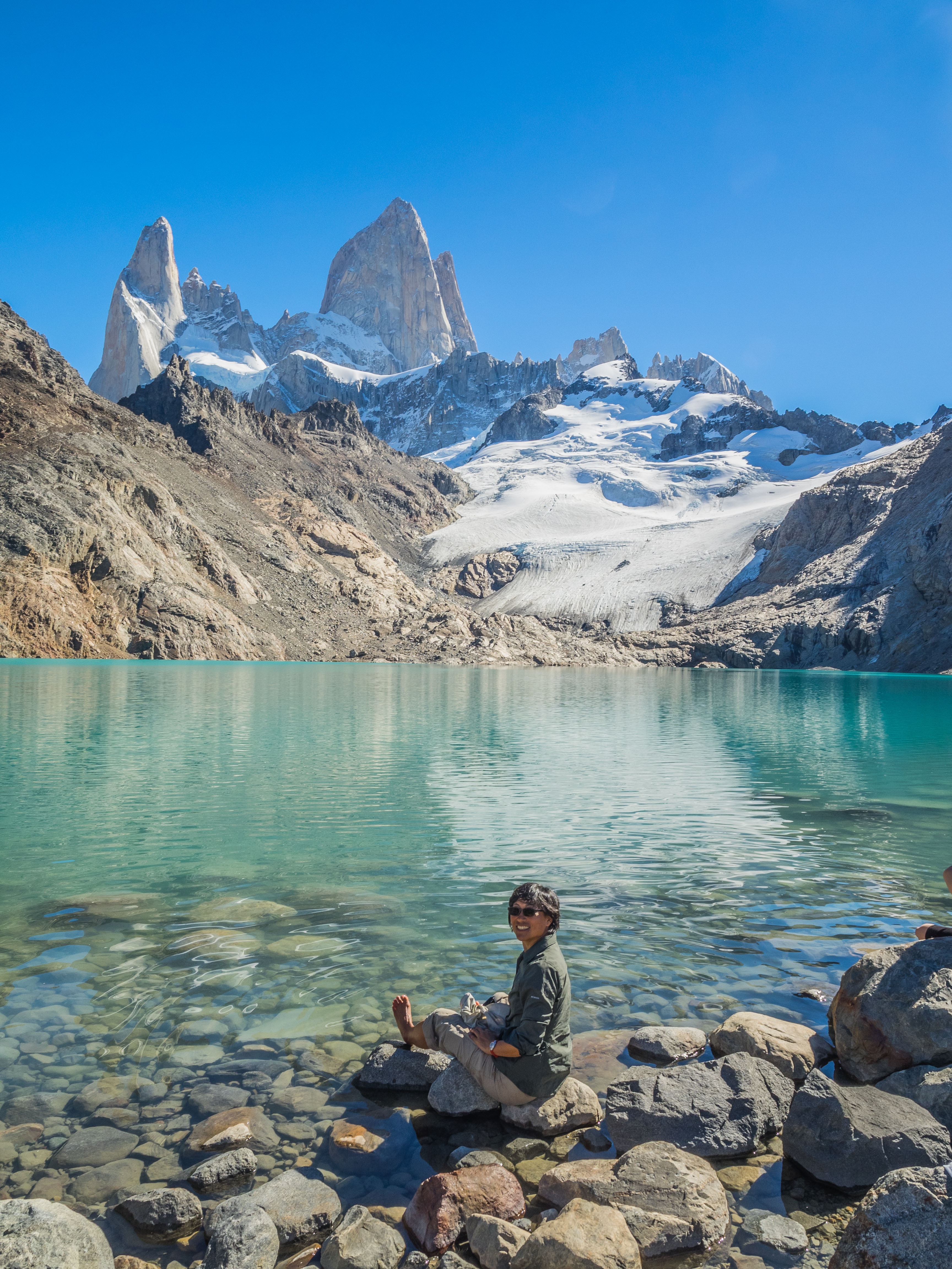
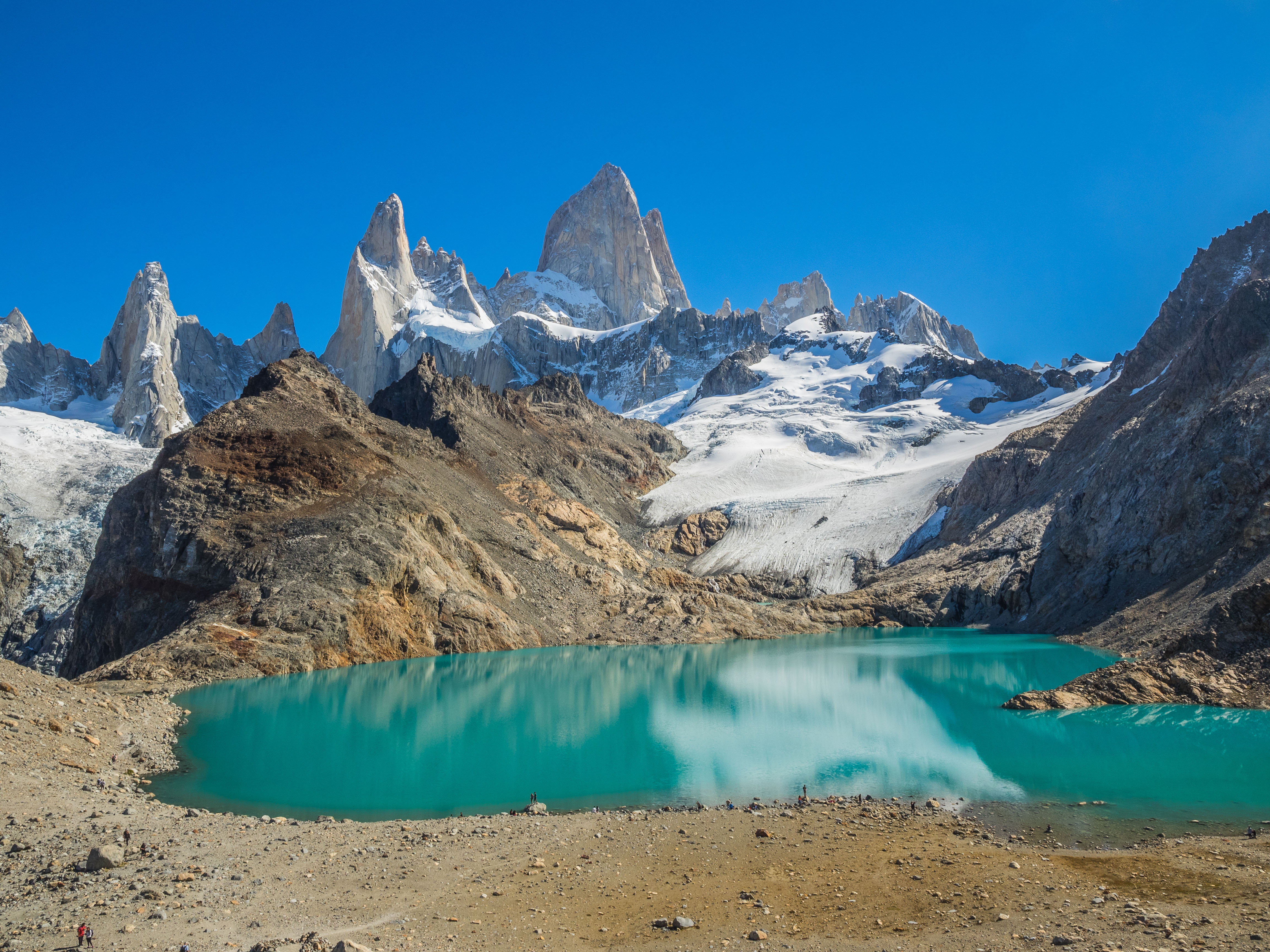
Once on top we were rewarded with stunning views of a turquoise blue Laguna surrounded by the crowning peaks of Fitz Roy. We found Sally and hung out on top soaking in the scenery and taking silly pictures.
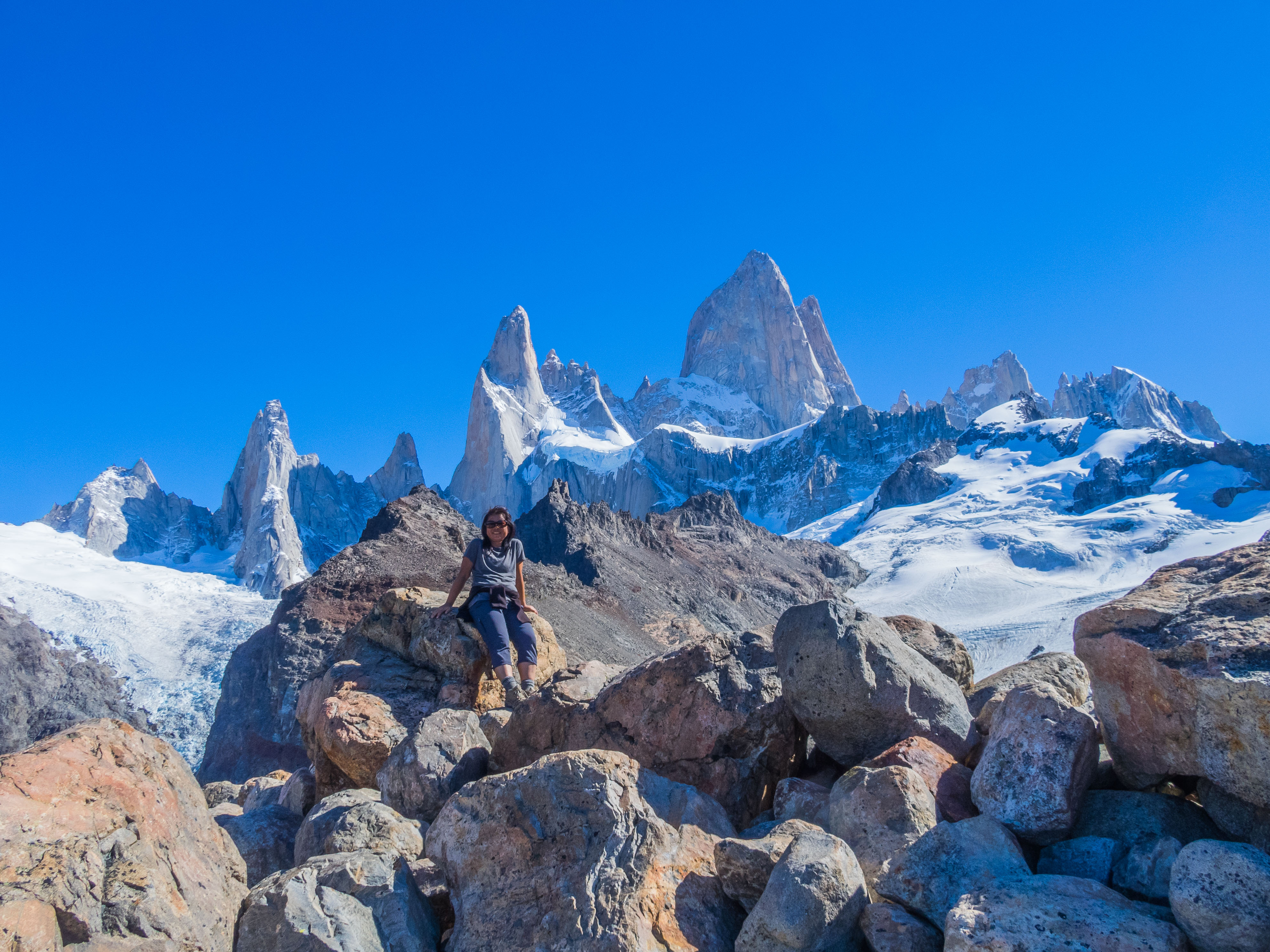
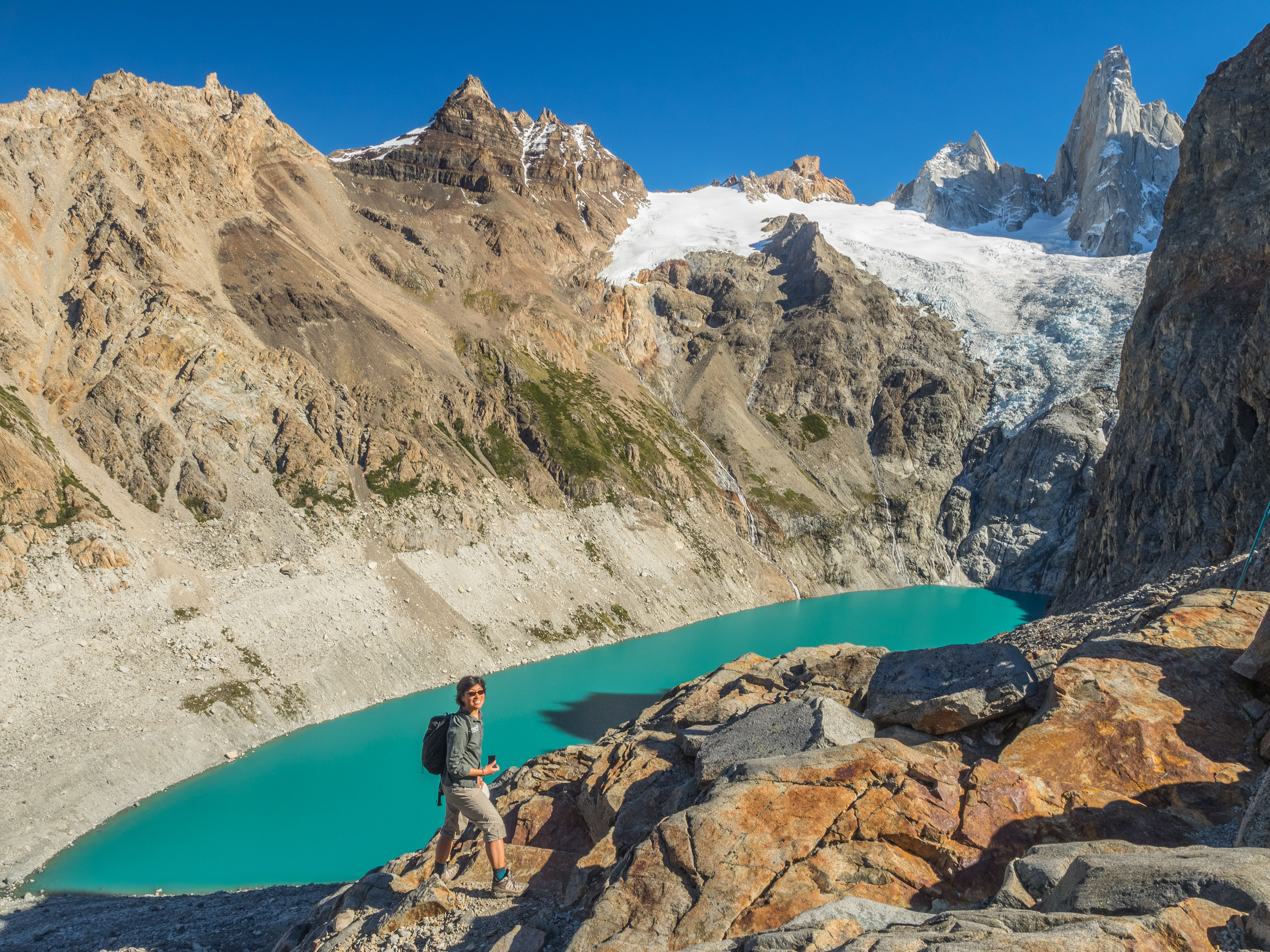
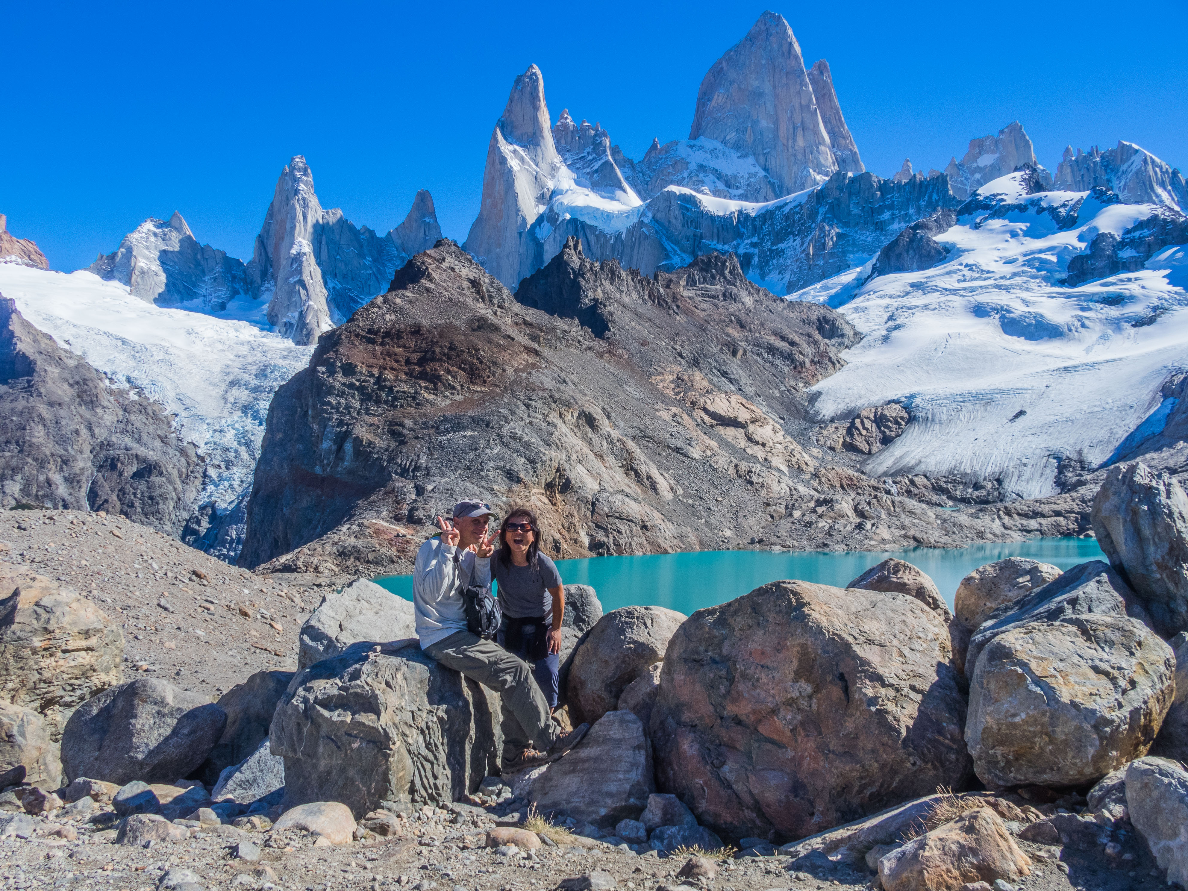 G & Sally hiked down to the Laguna and explored a smaller lake to its south while D was content to stay put and not move any more than necessary. She did miss out on these great views.
 The descent wasn’t much easier as there were some narrow parts that made it tricky to get around people who were climbing up.
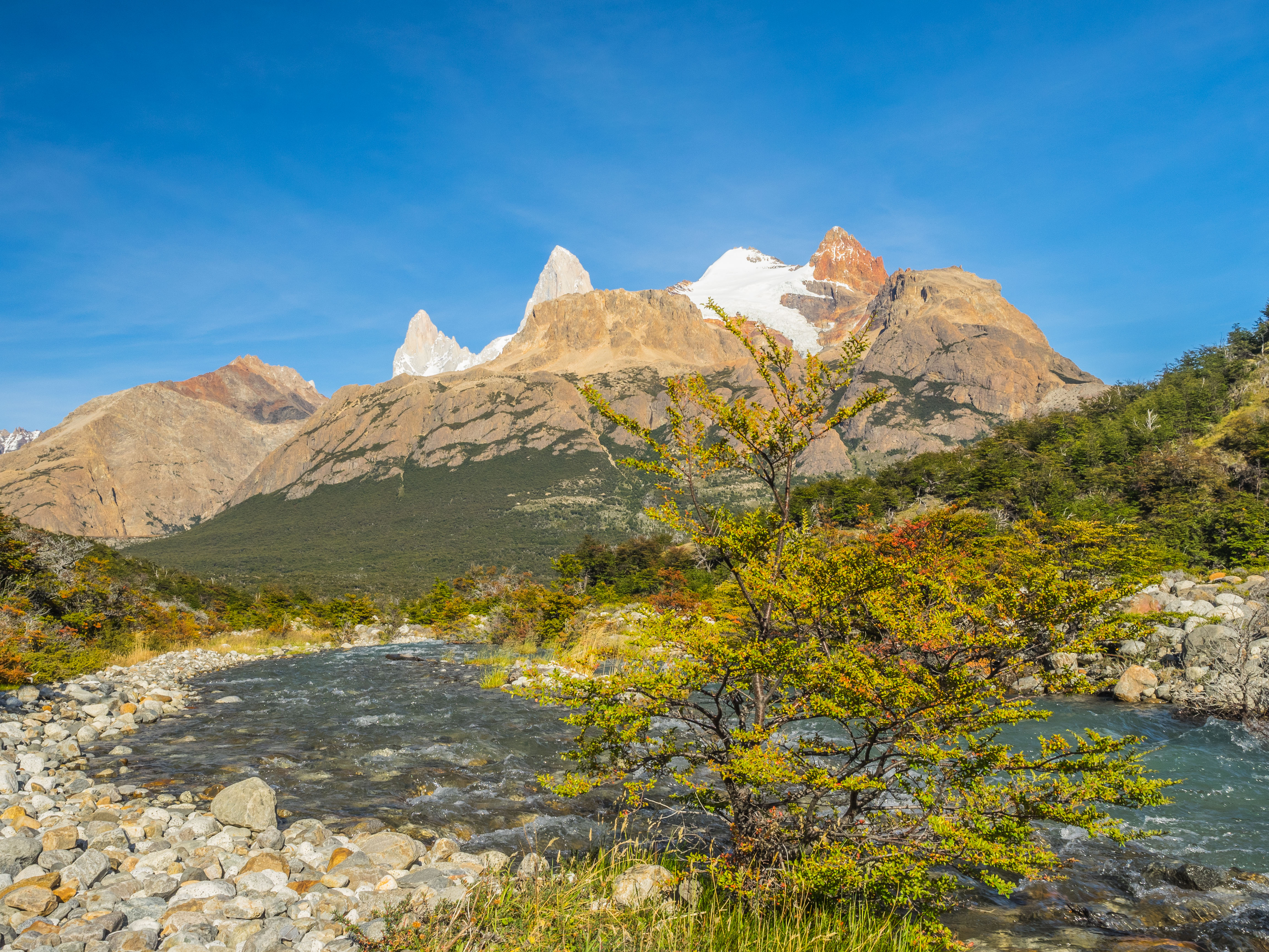
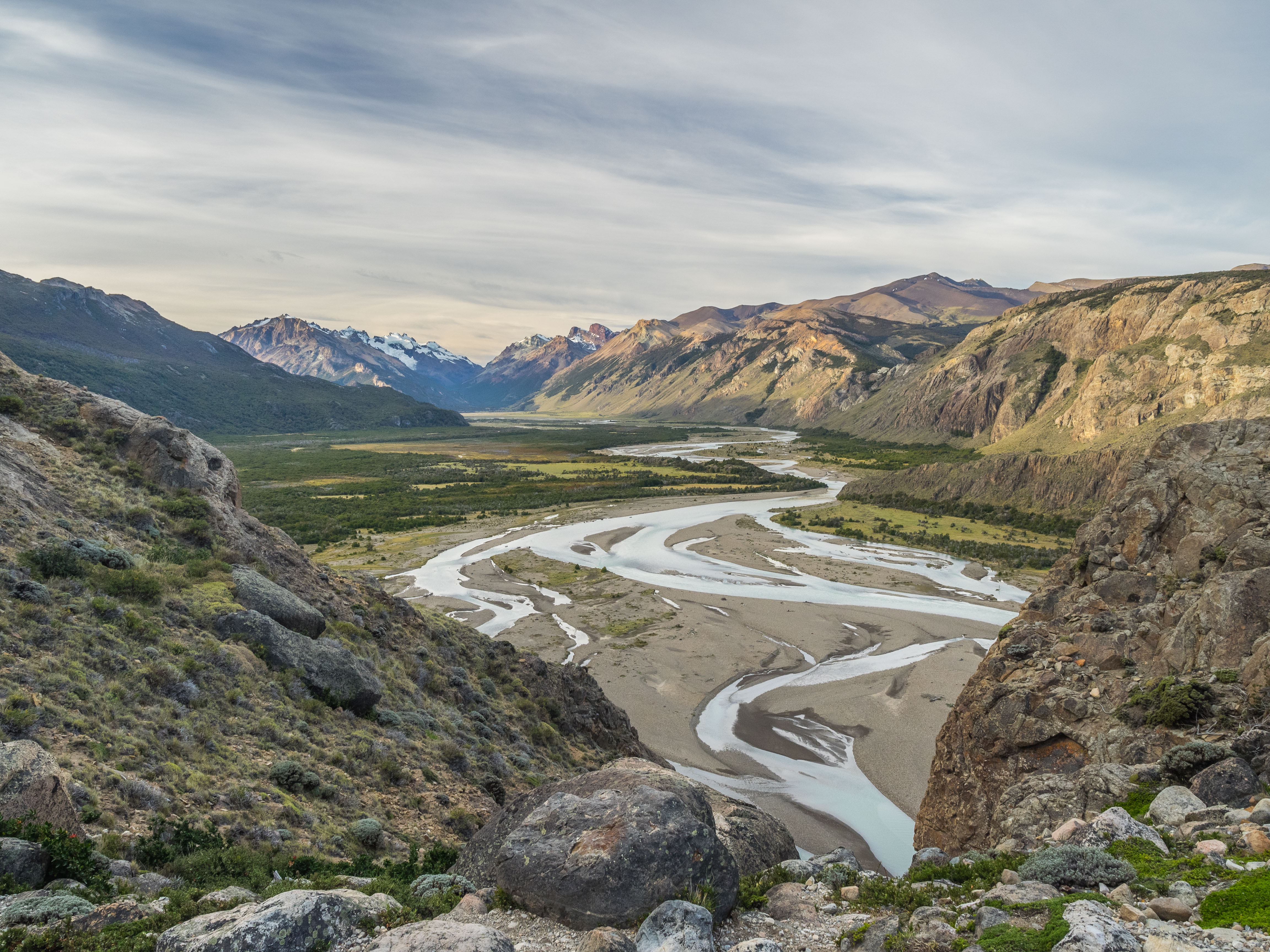
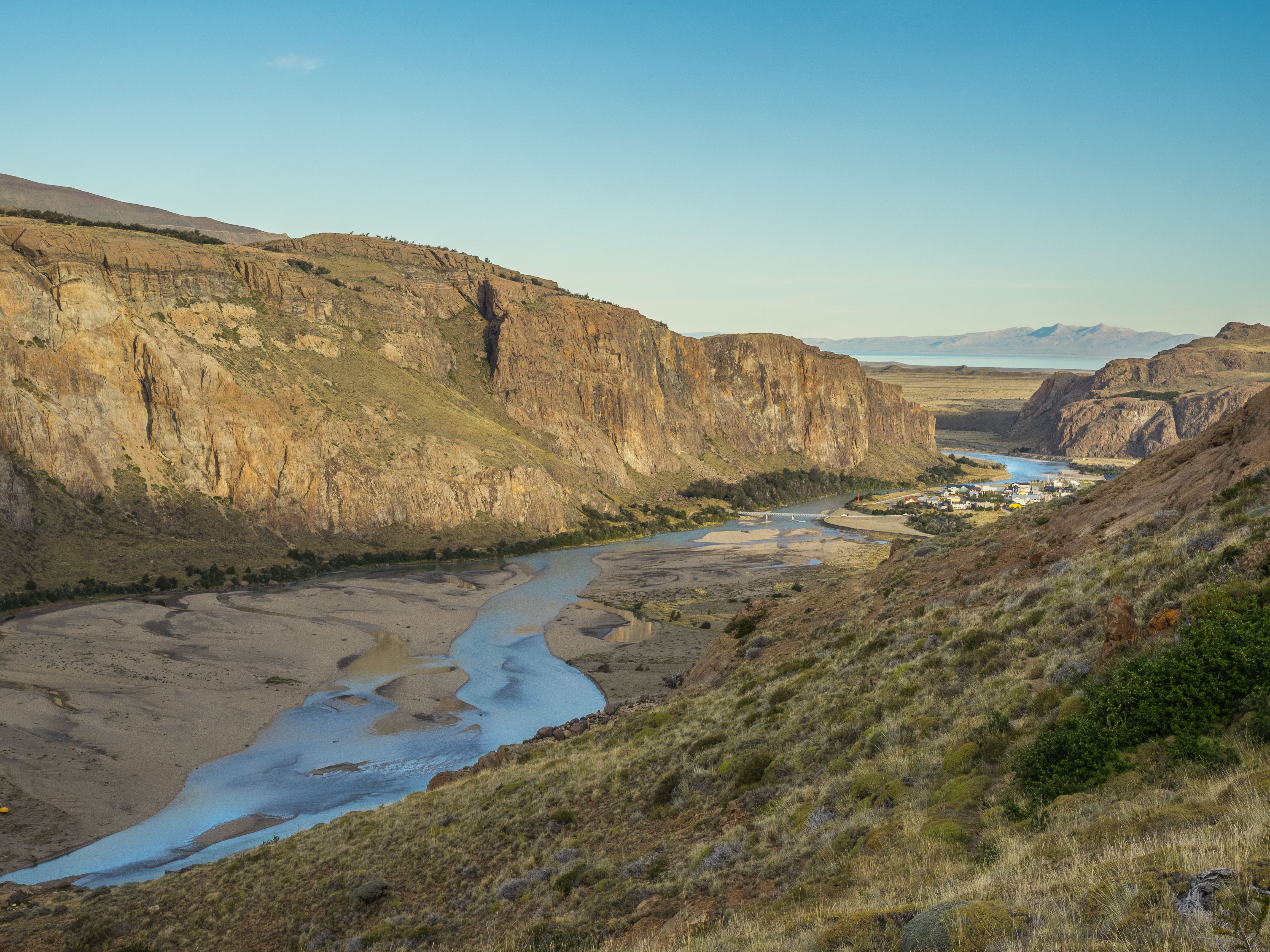
 Once we reached the bottom, we headed back to El Chalten by way of Laguna Capri and practically walked the whole way backwards to El Chalten to take in the views of Fitz Roy. Though Fitz Roy was backlit by this time the views were still amazingly gorgeous. Once closer to town we got great overhead views of the Rio de las Vueltas valley and El Chalten culminating the end to a near perfect day.
Trail Info:
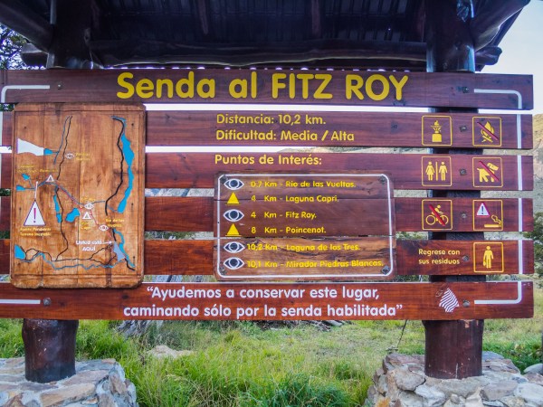
Length (RT): 20km /14 miles
Duration: 8 to 10 hours
Difficulty: Moderate, last km is steep
Why: The best views of Fitz Roy
From El Pilar the length of the hike is 18km or 13 miles.
Trivia: Fitz Roy is the same mountain that is on the Patagonia outdoor clothing logo. Go ahead and check it out, you know you want to.
Eats:
Techado Negro
El Chalten, Argentina
We ate here again as our first choice did not exist anymore. We ordered the lentil stew again (it was that good), Chicken Cazuela, Bife de Chorizo and a Bailey’s ice cream dessert that Sally absolutely loved.

Leave a comment